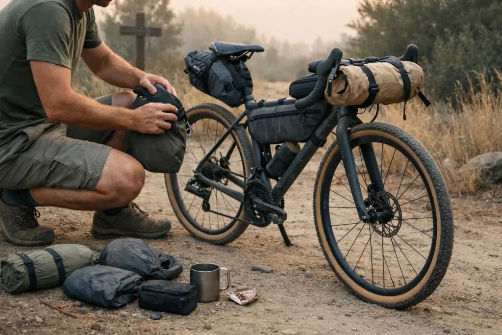
Best bikepacking routes live or die on one thing: the balance between wild and workable. Too remote and you’re hauling five days of food. Too developed and it feels like a hotel crawl on two wheels. The routes in this guide hit that sweet spot — tested, rideable, and genuinely rewarding for riders who prefer carrying less and experiencing more. Whether you’ve got two weeks or two months, there’s something here worth chasing.
I’ve spent the last decade testing routes across North America, Europe, and beyond — sometimes succeeding spectacularly, other times learning hard lessons about preparation and route selection. Every route below earns its spot by being doable with a minimalist setup: reliable resupply, dependable water, clear bailouts, and a realistic seasonal window. When two routes are equally pretty, the one with fewer logistical headaches ranks higher.
Find Your Best-Fit Bikepacking Route
Answer 4 quick questions and get a matched route plus a seasonal timing check — so you know exactly where to go and when.
What’s your bikepacking experience level?
How much time do you have?
What kind of adventure calls to you?
Which month are you planning to ride?
Table of Contents
- What Makes a Bikepacking Route Minimalist-Friendly?
- How to Choose Your Next Bikepacking Route
- Best Bikepacking Routes for Beginners
- Essential Planning Tools: GPX, Apps & Safety
- Route Spotlights: 10 Best Bikepacking Routes by Region
- Route Comparison at a Glance
- My Top 3 Personal Favorite Bikepacking Routes
- When to Ride: Seasonal Timing
- Planning Your First Bikepacking Adventure
- Your Next Steps: Pick a Route & Go
- Frequently Asked Questions
- Conclusion
What Makes a Bikepacking Route Minimalist-Friendly? ✓
Not every scenic trail translates into a good bikepacking experience when you're traveling ultralight. The sweet spot exists where adventure meets practicality. Here's the essential checklist for evaluating any route through a minimalist lens:
The Minimalist Route Checklist
Resupply Frequency
- ✅ Towns or stores every 50–100 miles (ideal for carrying 1–2 days of food)
- ⚠️ 100–150 miles between resupply (requires larger food bag)
- ❌ 150+ miles (forces you to carry excess weight, defeating minimalism)
Water Availability
- ✅ Natural sources every 20–30 miles with filtration
- ✅ Taps/fountains in towns along route
- ⚠️ Cache points required (adds complexity)
- ❌ Must carry 2+ days of water (too heavy for minimalist approach)
Bailout Points
- ✅ Road crossings or towns every 30–50 miles
- ✅ Cell service in emergency zones
- ⚠️ Requires satellite communicator for safety
- ❌ Multi-day commitment with no exit strategy
Surface & Terrain
- ✅ Gravel roads, doubletrack, smooth singletrack
- ⚠️ Technical singletrack (limits gear options)
- ⚠️ Significant hike-a-bike sections
- ❌ Requires specialized equipment
Navigation Complexity
- ✅ Well-marked or clear GPX track available
- ✅ Can navigate with phone app + backup map
- ⚠️ Requires detailed map reading skills
- ❌ Routefinding expertise essential
Seasonal Window
- ✅ 4+ month riding season
- ⚠️ 2–3 month window (requires precise timing)
- ❌ Narrow weather window (high risk)
Red Flags to Avoid
❌ Remote wilderness sections longer than 100 miles without resupply
❌ Seasonal routes with unpredictable opening dates
❌ Technical singletrack requiring specialized mountain bike skills beyond your current level
❌ Private land crossings without confirmed access permissions
The checklist above isn't about finding easy routes — it's about finding routes where your energy goes into the riding, not into logistics survival. A hard route with good resupply still lets you travel light. A moderate route with no water for 80 miles will wreck you regardless of fitness.
How to Choose Your Next Bikepacking Route
The most popular bikepacking routes — Great Divide, Tuscany Trail, Oregon Timber Trail — didn't earn that reputation by accident. They hit the minimalist sweet spot: manageable logistics, strong rider communities, and terrain that rewards light travel. Use them as your benchmark when evaluating anything else. In my experience, the format of a route matters almost as much as its terrain: a hard loop beats an easier point-to-point if you're driving solo and hate shuttle logistics. Four route formats cover most situations.
Point-to-point routes put you in new terrain every day but require shuttle logistics. Loop routes are the minimalist's best friend: start and finish at your car, no shuttle drama. Hub-and-spoke riding (day trips or overnighters from a base) is the lowest-commitment way to test a new region before committing. For experienced riders who want something uniquely their own, connector routes stitch existing trails into a custom adventure — maximum flexibility, but stronger navigation skills required.
Matching Routes to Your Goals
| Your Priority | Look For | Avoid |
|---|---|---|
| Solitude | Remote wilderness routes, weekday riding, shoulder season | Popular summer routes, weekend warriors |
| Cultural immersion | European routes, multi-country tours, village-to-village | Wilderness backcountry, remote forests |
| Physical challenge | Mountain passes, high elevation, technical terrain | Rail trails, flat routes |
| Beginner-friendly | Established routes, strong community, good infrastructure | Experimental routes, limited beta |
| Scenic variety | Point-to-point routes, multi-biome crossings | Single-terrain loops |
Best Bikepacking Routes for Beginners (Easy Wins)
If you want your first trip to feel adventurous rather than stressful, pick a route with frequent towns, simple navigation, and flexible sleeping options. These are the easiest starting points on the list:
- C&O Canal / GAP Trail (USA) — flat, well-signed, bailout points every 20–30 miles
- King Alfred's Way (England) — train stations throughout, pub at the end of every day
- Munda Biddi Trail — Northern Section (Australia) — purpose-built, dedicated campsites, clear signage
- Tuscany Trail (Italy) — loop format means zero shuttle logistics from Florence
- Otago Central Rail Trail (NZ) — gentle grades, strong support infrastructure
Quick pacing rule: start conservative on day one, then adjust after you see your real speed on that surface. Use the route quiz above to get a matched recommendation for your specific time window and experience level.
Essential Planning Tools: GPX, Apps & Safety 🗺️
Smart route planning starts long before you throw a leg over your bike. These resources help you research, plan, and navigate without breaking the bank or your minimalist principles.
GPX Sources & Route Databases
Bikepacking.com is the community's go-to: free route pages with elevation profiles, GPX downloads, water source notes, and rider trip reports. Ride with GPS adds a massive user-generated library with turn-by-turn phone navigation. Komoot excels on European routes with surface-type mapping that helps you spec gear before you leave. For North America, the Adventure Cycling Association maintains curated long-distance routes with decades of feedback, including detailed GDMBR resources.
Navigation Apps
For on-route navigation, Gaia GPS is the most robust option — solid offline maps, multiple layers, reliable tracking. OsmAnd is free and fully open-source. Komoot handles voice navigation well on mixed terrain. Whatever app you choose, download offline maps for your entire route before departure. Cell service is unreliable in remote areas, and a dead phone shouldn't mean a dead end. For a full breakdown of Gaia vs AllTrails and which to use where, see the GPS navigation for bikepacking guide.
Safety & Communication
For routes with 50+ mile sections without cell service, a satellite communicator is worth serious consideration. Garmin inReach devices offer two-way messaging; SPOT devices provide emergency SOS. For weather, Mountain-Forecast.com gives elevation-specific forecasts that standard weather apps miss entirely. Always share your route GPX with a trusted contact before departure and know your bailout points.
| Device | Best For | Two-Way Messaging | Price |
|---|---|---|---|
| Garmin inReach Messenger | Riders who want Garmin ecosystem + tracking | ✅ Yes | ~$165 |
| ZOLEO Satellite Communicator | Riders who want app-based simplicity + lower entry cost | ✅ Yes | ~$149 |
Free planning resource: The Adventure Cycling Association maintains a searchable route network database at adventurecycling.org — the most reliable free source for North American bikepacking routes, with rider-reported conditions updated regularly.
Route Spotlights: 10 Best Bikepacking Routes by Region
These are the best bikepacking destinations on the planet — from Scottish Highlands to Chilean Patagonia — filtered through a minimalist lens. Each card gives you the fast facts so you can scan and shortlist before reading deeper. Difficulty rated on 3 points: Mellow, Challenging, Epic.
🇺🇸 North America
Great Divide Mountain Bike Route
The defining North American route. Towns arrive on a steady rhythm, the riding is fast on doubletrack, but Montana's grizzly country and New Mexico's desert demand respect. Best tackled southbound from Banff.
Oregon Timber Trail
Cascade fir to high desert juniper in one route. Excellent documentation, good resupply rhythm, and terrain variety that keeps every day feeling different. Watch for smoke in late August.
Colorado Trail
Almost entirely above 10,000 ft. Afternoon thunderstorms are a daily reality; some sections are hike-a-bike. Water is abundant. The alpine scenery is unmatched anywhere in the Lower 48.
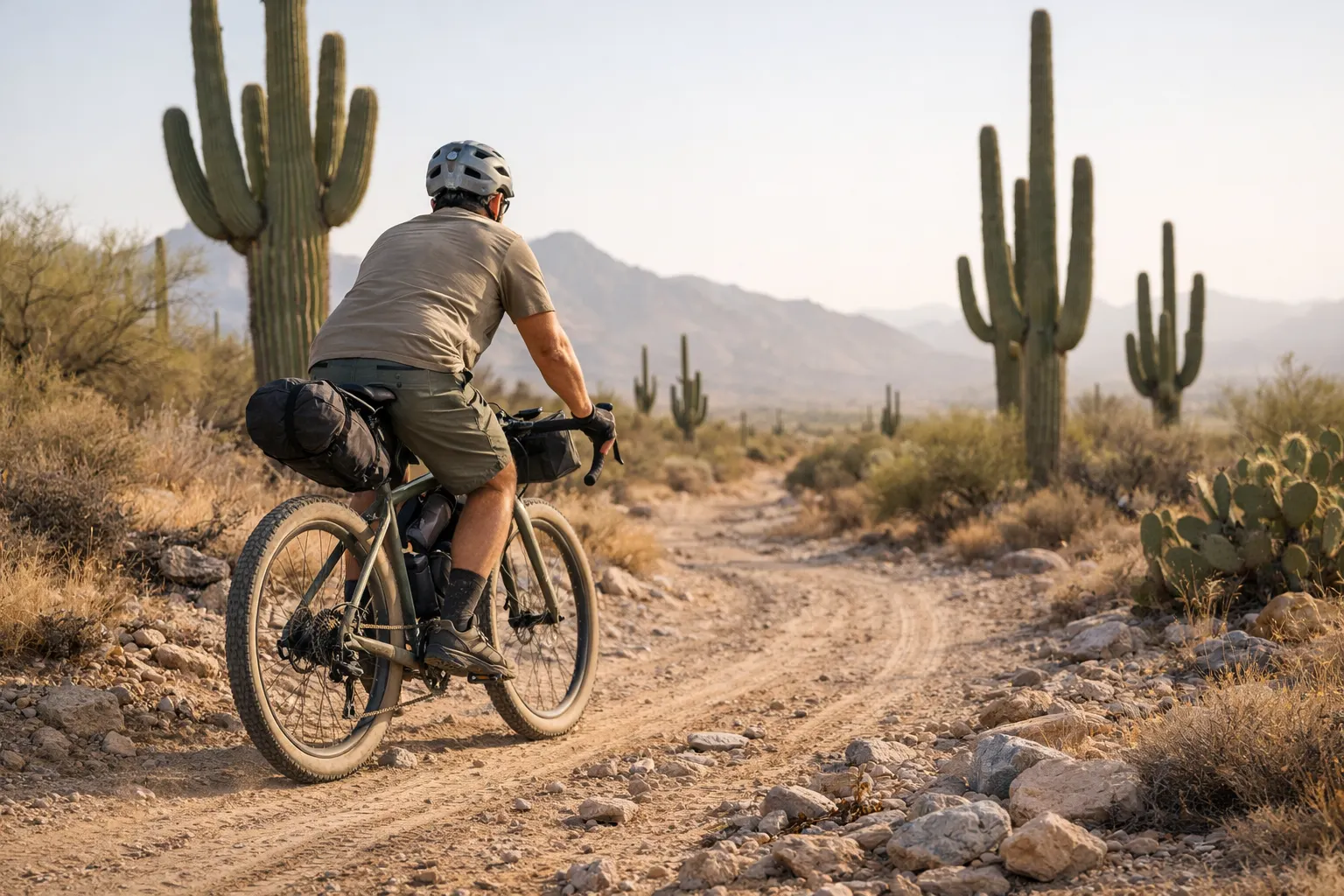
Arizona Trail
Saguaro forests, canyon country, genuine solitude. Water planning is non-negotiable. Avoid summer entirely. Spring and fall windows are outstanding.
🇪🇺 Europe
Tuscany Trail
The minimalist's cultural trip: carry almost nothing, eat everything. Hard climbs on unmarked farm tracks, then fresh pasta in hilltop villages. Loop format means zero shuttle logistics from Florence.
Highland Trail 550
Europe's most brutal off-road route. Rain, midges, remote glens, and some of the most dramatic landscapes anywhere. Wild camping is legal and expected. A satellite communicator isn't optional here.
King Alfred's Way
The ideal first international route: easy bailouts at every turn, historic countryside, and a pub at the end of almost every day. Navigation through the bridleway network takes focus — download the GPX.
🌍 Global Bucket List
Carretera Austral
Chilean Patagonia: glaciers, fjords, and villages only reachable by dirt road or ferry. Infrastructure is improving but still genuinely wild. Miss a ferry and your whole timeline shifts.
Munda Biddi Trail
Purpose-built for bikepacking: dedicated campsites, water tanks, clear signage, smooth surface. Perth to Albany through jarrah forest. For beginners after their first long route, it's hard to beat.
Tour Aotearoa
New Zealand's answer to the Great Divide, crossing both islands from Cape Reinga to Bluff. Outstanding infrastructure, jaw-dropping scenery. Factor in the Cook Strait ferry and variable mountain weather.
Route Comparison at a Glance
Quick answer: the best bikepacking routes depend on experience level — beginners should start with King Alfred's Way or Munda Biddi Trail, intermediate riders do well on the Oregon Timber Trail or Tuscany Trail, and advanced riders can take on the Great Divide or Tour Aotearoa.
Use this table to shortlist your next adventure. Sort by what matters most to you — difficulty, distance, or season.
| Route | Distance | Difficulty | Best Season | Surface | Minimalist ★ |
|---|---|---|---|---|---|
| King Alfred's Way | 220 mi | Mellow | Apr–Oct | Bridleways/gravel | ★★★★★ |
| Tuscany Trail | 280 mi | Challenging | Apr–Jun, Sep–Oct | Gravel roads | ★★★★★ |
| Munda Biddi Trail | 620 mi | Mellow | Apr–Oct | Smooth gravel | ★★★★★ |
| Oregon Timber Trail | 670 mi | Challenging | Jul–Sep | Mixed singletrack | ★★★★½ |
| Colorado Trail | 486 mi | Epic | Jul–Sep | 70% singletrack | ★★★★ |
| Tour Aotearoa | 1,900 mi | Epic | Nov–Mar | Mixed | ★★★★ |
| Carretera Austral | 770 mi | Challenging | Dec–Mar | Gravel road | ★★★½ |
| Arizona Trail | 800 mi | Challenging | Mar–May, Sep–Nov | 50% singletrack | ★★★ |
| Great Divide MBRT | 2,700 mi | Epic | Jun–Sep | 90% dirt road | ★★★★ |
| Highland Trail 550 | 550 mi | Epic | May–Sep | Singletrack/doubletrack | ★★★ |
My Top 3 Personal Favorite Bikepacking Routes 🏆
Numbers, cards, and tables can only tell you so much. Here's why these three routes stand above the rest from a personal standpoint.
#1: Oregon Timber Trail
The OTT never overstays its welcome. The moment the dense Cascade fir gives way to high desert juniper somewhere south of Bend — that landscape shift makes you stop pedaling just to look. You're carrying 2–3 days of food maximum the whole way, which keeps the bike nimble and the legs fresh. It's the best combination of achievable distance, varied terrain, and minimalist-friendly resupply I've found on a North American route.
I've ridden this twice — once solo, once with a small group — and the community around it, from trail angels to online forums, makes planning feel supported rather than overwhelming.
#2: Tuscany Trail
This route proves minimalist bikepacking doesn't require suffering. A credit card and a water filter are almost all you need. The standout moment isn't a summit — it's rolling into a tiny village at sunset, finding a trattoria, eating the best meal of your life while locals gather in the piazza. No other route I've ridden balances physical challenge with genuine cultural reward the way Tuscany does.
#3: Colorado Trail
The CT demands respect — most of it sits above 10,000 feet and the afternoon thunderstorms are real. But crossing above treeline in the Collegiate Peaks, completely self-sufficient, surrounded by 14,000-foot summits, is the kind of moment that reframes what you think you're capable of. The frequent road crossings make it more manageable than the elevation suggests.
When to Ride: Seasonal Timing 🌦️
The same route can be transcendent in April and genuinely dangerous in July. Here's the fast version by season, then route-specific rules worth burning in.
Spring (March–May)
- Best picks: Arizona Trail, Tuscany Trail, Shimanami Kaido, low-elevation desert routes
- Watch-outs: Snow on mountain passes, mud season above 7,000 ft, unpredictable transitions
- Pack weight: ✅ Lightest — no heavy cold-weather kit needed
Summer (June–August)
- Best picks: Great Divide, Colorado Trail, Highland Trail 550, high-mountain routes
- Watch-outs: Afternoon thunderstorms in Rockies, wildfire smoke (US West from late July), European crowds and heat
- Pack weight: ✅ Minimal shelter — bivvy camping fully viable
Fall (September–November)
- Best picks: Arizona Trail, Tour Aotearoa, Carretera Austral (Southern Hemisphere spring)
- Watch-outs: Shorter days, early high-elevation snow after mid-September, hunting season in some areas
- Pack weight: ✅ Sweet spot — stable weather, lighter crowds
Winter (December–February)
- Best picks: Baja Divide, Florida routes, southern AZ low sections, New Zealand, Australia
- Watch-outs: ❌ Most Northern Hemisphere mountain routes snow-blocked or dangerous
- Pack weight: ⚠️ Heavier — insulation and rain gear required
A few route-specific rules worth burning in: the Great Divide runs southbound June–late September. The Oregon Timber Trail window is July to early August before smoke peaks. For European routes, August is the worst month — heat, full tourist prices, crowds. Any desert route follows the same rule: March–April or October–November, never summer at low elevation.
Planning Your First Bikepacking Adventure
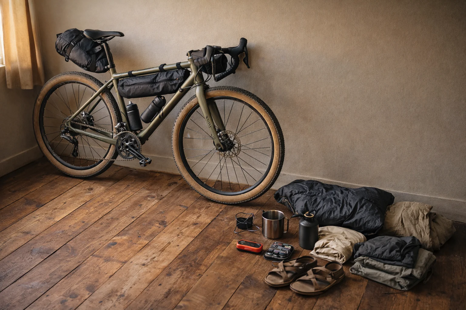
Start with honest self-assessment: fitness, available time, and what kind of adventure genuinely excites you. Then match the route to that reality — not the other way around. Tire width is the one gear detail worth settling before you commit: 38–50mm for gravel-heavy routes, 2.0"+ for singletrack-heavy ones.
Beginners should pick a 2–4 day section of a longer route rather than committing to the full thing. Good starting points: King Alfred's Way, C&O Canal/GAP Trail (USA), or Munda Biddi Trail sections.
Intermediate riders are ready for complete routes in the 400–800 mile range. Challenge yourself with one new element — elevation, remoteness, or technical terrain — but not all three at once. The Oregon Timber Trail, Tuscany Trail, and Colorado Trail all sit here.
Advanced bikepackers can take on the full Great Divide, Tour Aotearoa, or start building custom connector routes between existing trails.
Your Next Steps: Pick a Route & Go
You've got the map. Use the quiz above to get your matched route, cross-check it against the comparison table, then head to Bikepacking.com and download the GPX. Check the most recent trip reports — conditions change faster than any guide can update — and plan your gear around what the route actually demands, not a generic packing list.
- Free USA Bikepacking Routes Guide — deeper breakdown of American routes
- Bikepacking Route Planning Guide — how to build and customize your own route
- Bikepacking Gear Essentials — what to carry for minimalist adventures
- Travel Insurance for Bikepackers — worth reading before international routes
- Bikepacking for Beginners — start here if you're new to the sport
Frequently Asked Questions
Conclusion
The routes are mapped. The tools are free. Whether that's the Tuscany Trail for your first international loop, the Oregon Timber Trail for your first long route, or the Great Divide for the big one — the only real barrier is picking a direction and committing to it. So use this guide as your shortlist, download the GPX for whichever route is calling loudest, and go find out what your legs are capable of.
Now get out there and ride. 🚴
This guide is for general education and planning purposes. Route conditions, water sources, and trail access change seasonally — always verify current conditions through official land management agencies and recent rider reports before departure. Ride within your abilities and consult local experts for safety-critical decisions.