Free bikepacking routes USA riders can actually use without permits are harder to find than most lists make it seem. These seven routes are the ones I’ve actually ridden — chosen for legal free camping, realistic water access, and no required bookings. They’re part of a bigger best bikepacking routes shortlist, but these seven earn their own post.
I’ve spent the last five years riding budget-friendly routes across the country, from Sonoran Desert singletrack in February to Montana forest roads in August. Some cost me nothing beyond food and gas. Others I nearly abandoned because I hadn’t planned the water right. These seven made the final list because they’ve proven themselves on repeat visits with different conditions.
Quick note on “free”: No required permits or camping fees (small optional day-use or parking fees may apply). The riding and camping itself doesn’t depend on paid bookings or tour fees.
Table of Contents
- At a Glance: All 7 Routes Compared
- The 7 Routes
- Not Sure Which One? Use the Finder
- How to Verify Conditions Before You Go
- Trip Prep: Checklist + What to Do When Plans Break
- Frequently Asked Questions
- Conclusion
At a Glance: All 7 Routes Compared
Before you dive into the full writeups, here’s a detailed side-by-side comparison of the best free bikepacking routes in the USA — including water gaps, camping access, and skill-level match. Find your terrain type and difficulty, then jump straight to the route that fits.

| # | Route | Distance | Terrain | Difficulty | Days | Max water gap | Best season | Who it’s for |
|---|---|---|---|---|---|---|---|---|
| 1 | Arizona Trail (Tucson–Oracle) | 85 mi | Desert singletrack | Moderate | 1–2 | ~25 mi | Feb–Apr, Oct–Nov | Desert lovers, winter escapees |
| 2 | Kokopelli Trail (Utah) | 70 mi | Slickrock + doubletrack | Hard | 2–3 | ~30 mi | Mar–May, Sep–Nov | Technical riders, desert obsessives |
| 3 | Olympic Discovery Trail | 45 mi | Rail-trail + road | Easy | 1–2 | ~15 mi | Apr–Oct | Beginners, families, first overnighters |
| 4 | Colorado Trail (Seg 1–3) | 75 mi | High-altitude singletrack | Hard | 2–4 | ~10 mi | Jul–Sep | Fit riders wanting a mountain test-piece |
| 5 | Pine Creek Rail-Trail | 62 mi | Crushed limestone rail-trail | Easy | 1–2 | ~20 mi | May–Oct | East Coasters, beginners, fall foliage seekers |
| 6 | Great Divide (Whitefish–Lincoln) | 95 mi | Dirt/gravel forest roads | Moderate–Hard | 2–4 | ~45 mi | Jul–Sep | GDMBR-curious riders, mountain lovers |
| 7 | Natchez Trace (Nashville–Hohenwald) | 78 mi | Paved parkway | Easy–Moderate | 1–2 | ~25 mi | Mar–May, Sep–Nov | Pavement tourers, history buffs, first overnighters |
Quick picks by category: 🏜️ Best desert route: Arizona Trail (Tucson–Oracle) · 🌲 Best forest route: Pine Creek Rail-Trail · ⛰️ Best mountain route: Colorado Trail Segments 1–3 · 🛣️ Best pavement route: Natchez Trace Parkway · 🚴 Best beginner route: Olympic Discovery Trail · 🔥 Most challenging: Kokopelli Trail (Utah Section) · 🌵 Most remote: Great Divide Mountain Bike Route
Not sure which one fits you? Jump to the Route Finder tool — answer three questions and get an instant match.
7 Free Bikepacking Routes USA Riders Can Use Without Permits
Each of the free bikepacking routes USA entries below has a water gap summary, typical riding time, and a “Last Verified” date — use that as your cue to re-check conditions before you commit. All stats tie back to the comparison table above.
1. Arizona Trail — Tucson to Oracle (Arizona)
Desert singletrack, manageable water, winter-perfect timing.
Why ride it: I rode this in March 2024, a week after light rain. The wildflowers were absurd: saguaros blooming, red penstemon everywhere, morning light that makes you stop pedalling just to look. The climb out of Tucson is honest work, but the descent into Oracle is one of those stretches you think about for years. Proper water planning is crucial for desert routes like this one.
Trail reality: The Sonoran Desert is underrated as bikepacking terrain. You’re not fighting sand; it’s rocky singletrack that rewards a light touch on the front wheel. Just don’t skip the water carry. Water planning is the first thing beginners underestimate on desert routes.
- 🗻 Terrain: Desert singletrack, moderate climbs through the Santa Catalinas
- Difficulty: Moderate — rideable for intermediates, some hike-a-bike on steeper sections
- Best season: Feb–Apr, Oct–Nov (summer heat is genuinely dangerous here)
- Elevation gain: ~4,000–6,000 ft depending on line choices
- Typical time: 1–2 days
- Resupply: Tucson at the start; Oracle at the finish — carry full food between
- Access/Parking: Trailhead parking rules vary — confirm hours and fees before leaving a car overnight
- 💧 Water Sources: Tucson (start), Molino Basin spigot (~mile 25), Oracle (finish)
- 🏕️ Camping: Dispersed camping on Coronado National Forest sections
- 📅 Last reviewed: January 2026
The honest watch-out: Heat moves in fast after mid-April. I’ve seen riders underestimate a warm morning and get into real trouble by early afternoon. Start early and don’t skip Molino Basin even if you feel fine at mile 20.
2. Kokopelli Trail — Utah Section
Technical red rock, true self-sufficiency, the best night skies I’ve seen from a sleeping bag.
Why ride it: This one broke me a little, in the best way. The second day, after a long push through loose rock with the canyon dropping away on my right, I found a flat spot above the Colorado and just sat there for twenty minutes. No permit needed. No ranger checking anything. Just desert, the river below, and a sky that goes properly dark at altitude. Proper camping techniques are essential for remote sections like this one.
Trail reality: The slickrock sections test your nerve more than your legs. Traction is better than you’d expect on clean rock — it’s the loose decomposed granite in between that demands attention. Keep your weight back on descents and you’ll manage.
- 📍 Distance: 70 miles (Utah portion, Moab to Dewey Bridge area)
- 🗻 Terrain: Slickrock, desert doubletrack, loose rock technical sections
- Difficulty: Hard — you need to be comfortable with exposure and route-finding
- Best season: Mar–May, Sep–Nov (avoid summer entirely — shade is scarce)
- Elevation gain: ~5,000–8,000 ft
- Typical time: 2–3 days
- Resupply: Moab only — plan to be fully self-sufficient or cache water at Dewey Bridge
- Access/Parking: Popular Moab trailheads fill fast on weekends — have a backup lot or shuttle plan
- 💧 Water Sources: Moab (start), Colorado River at Dewey Bridge (~mile 30), then limited
- 🏕️ Camping: BLM dispersed camping throughout — one of the more generous setups in the country
The one thing to respect here: Flash flood risk is real — check weather not just at the trailhead but upstream. A blue sky above the canyon means nothing if it’s raining 30 miles east. The BLM Grand Resource Area office in Moab has current conditions: blm.gov camping.
3. Olympic Discovery Trail — Port Townsend to Sequim
The friendliest first overnighter in the Pacific Northwest — one of the best beginner bikepacking routes USA has going.
Why ride it: I brought someone on their first overnight trip on this route. Not a cyclist, not a camper — just someone who wanted to try it. By the end of day one, watching the Olympic Mountains catch the last light over the Strait of Juan de Fuca, she was already talking about what to do next. That’s what this trail does to people.
Trail reality: The riding itself is forgiving. Rail-trail grades mean you’re never grinding — you’re just moving through genuinely beautiful Pacific Northwest scenery at a pace that lets you actually see it. I learned this on my third visit: don’t overthink this route. The simplicity is the whole point.
Water reality: Port Townsend, Discovery Bay, Sequim — plus forest sources that need purification. No long gaps; this is the easiest water logistics on the list.
- 📍 Distance: 45 miles
- 🗻 Terrain: Gravel rail-trail with short paved and road link sections
- Difficulty: Easy — genuinely manageable on almost any bike with decent tires
- Best season: Apr–Oct (Pacific Northwest rain is manageable outside of winter)
- Elevation gain: Low — gentle grades throughout
- Typical time: 1–2 days
- Resupply: Port Townsend, Discovery Bay (~mile 15), Sequim — towns are frequent and well-stocked
- Access/Parking: Town lots and trailheads have different overnight rules — double-check before staging a car
- 💧 Water Sources: Port Townsend, Discovery Bay, Sequim — plus forest sources that need purification
- 🏕️ Camping: Fort Worden State Park at the start; dispersed camping on Olympic National Forest lands along the corridor
The honest watch-out: The trail has a few road gap sections that aren’t always well-marked. Download offline maps before you leave and don’t rely on cell signal between towns — it drops consistently in the forested sections.
4. Colorado Trail — Segments 1–3
High altitude, real singletrack, and clear proof that the best mountain riding in the country doesn’t need a permit.
Why ride it: The first time I crested into the high country above Waterton — above the trees, wind coming across the ridge, 10,000 feet and a view that goes to Denver — I understood why people do this route obsessively. It’s the kind of riding that recalibrates what you think is possible on a loaded bike.
Trail reality: These opening segments give you everything: the elevation, the exposure, wildflower meadows in late July, bighorn sheep on the ridge. At 75 miles you can test yourself without committing weeks of your life to the full 486-mile route — download the GPX before committing to the climb.
Water reality: Waterton Canyon, South Platte River, creek crossings throughout — reliable and frequent above the canyon. Shortest max gap on the list at ~10 miles, but treat the alpine streams regardless.
- 📍 Distance: 75 miles
- 🗻 Terrain: High-altitude singletrack with sustained climbing
- Difficulty: Hard — elevation and technical trail demand fitness and acclimatization
- Best season: Jul–Sep (snow can close this as late as June, as early as October)
- Elevation gain: ~9,000–12,000 ft
- Typical time: 2–4 days
- Resupply: Limited within the route — plan a full food carry or plan specific town detours
- Access/Parking: Waterton Canyon trailhead is busy — confirm parking rules and current capacity limits
- 💧 Water Sources: Waterton Canyon, South Platte River, creek crossings throughout — reliable and frequent above the canyon
- 🏕️ Camping: Dispersed camping above treeline and in designated Colorado Trail corridor areas
- 📅 Last reviewed: September 2025
The honest watch-out: Afternoon lightning above treeline is a real hazard in July and August, not just an inconvenience. Start early, be below treeline by noon if storms are in the forecast, and don’t push it. The mountains don’t care about your timeline.
5. Pine Creek Rail-Trail — Ansonia to Jersey Shore
Pennsylvania’s answer to “what if a bikepacking route just worked, every single time.”
Why ride it: This is the route I recommend to people who say they want to try bikepacking but aren’t sure they’re ready. You’re ready. The gorge is genuinely dramatic — the Pennsylvania Grand Canyon earned that name — and the rail-trail surface means you can actually look around without white-knuckling the bars the whole way.
Trail reality: In October the walls of the gorge go orange and red. The light in the late afternoon hits the canyon walls differently than anywhere else I’ve ridden. It’s not a hard trip, but it’s a beautiful one, and sometimes that’s exactly what you need. On my last ride here, the forest trail markers were fresh — campsite selection skills come in handy when the established sites are crowded.
Water reality: Ansonia, Wellsboro, Blackwell, Jersey Shore — plus Pine Creek itself as a backup (purify). No gaps over ~10 miles; the lowest water stress on this entire list.
- 📍 Distance: 62 miles
- 🗻 Terrain: Crushed limestone rail-trail through Pine Creek Gorge
- Difficulty: Easy — accessible on any bike with tires wider than 28mm
- Best season: May–Oct (fall foliage in September–October is peak)
- Elevation gain: Minimal — the grade is gentle throughout
- Typical time: 1–2 days
- Resupply: Wellsboro, Blackwell, Jersey Shore — towns every 15–20 miles
- Access/Parking: Small-town access is relaxed — confirm overnight parking rules if staging a car
- 💧 Water Sources: Ansonia, Wellsboro, Blackwell, Jersey Shore — Pine Creek itself as a backup (purify)
- 🏕️ Camping: Pennsylvania State Forest dispersed camping, plus established campgrounds along the corridor
What catches people out: The trail gets busy near Wellsboro on fall weekends. Start mid-week or early morning in October — the experience is completely different without the crowd.
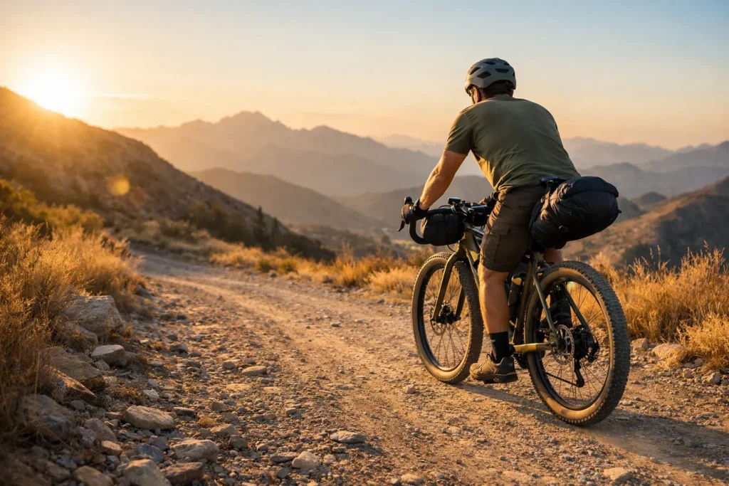
6. Great Divide Mountain Bike Route — Whitefish to Lincoln
A genuine taste of the GDMBR, without the months-long commitment.
Why ride it: The forest roads here are wild in a way the Southwest isn’t — denser, greener, the mountains hulking and close. Glacier is just off your left shoulder the whole time. You’ll see more wildlife in two days here than in a week on most other routes I’ve ridden.
Trail reality: This section is the ideal GDMBR test drive. I learned this the hard way: navigation is straightforward by Divide standards, the Eureka resupply is reliable, and Lincoln is a satisfying finish. If you ride this and want more, you’ll start planning the full route before you get back to your car.
Water reality: Whitefish, Eureka (~mile 45), Lincoln — mountain streams throughout (seasonal, confirm flow). The 45-mile gap Eureka makes this the longest water stretch on the list — carry water purifier and backup tablets.
- 📍 Distance: 95 miles
- 🗻 Terrain: Dirt and gravel forest roads with mountain passes
- Difficulty: Moderate to Hard — sustained climbs and remote sections demand self-sufficiency
- Best season: Jul–Sep (snow can persist late into June; check conditions carefully)
- Elevation gain: ~8,000–12,000 ft
- Typical time: 2–4 days
- Resupply: Eureka at roughly mile 45, then Lincoln — plan food carefully between those two points
- Access/Parking: Remote access points vary — confirm start/finish parking before you drive out there
- 💧 Water Sources: Whitefish, Eureka (~mile 45), Lincoln — mountain streams throughout (seasonal, confirm flow)
- 🏕️ Camping: Flathead and Helena-Lewis and Clark National Forest dispersed camping throughout
- 📅 Last reviewed: August 2025
The honest watch-out: Mountain streams look great on a map but flow rates vary dramatically. Treat streams as bonus water and plan around the confirmed town sources at Eureka and Lincoln — don’t count on any specific creek being reliably full.
7. Natchez Trace Parkway — Nashville to Hohenwald
Smooth, historic, and the most stress-free overnighter on this list.
Why ride it: I was skeptical before I rode this. Paved parkway, rolling farmland, no dramatic scenery — on paper it sounds like a warmup route. Then I spent a morning at the Meriwether Lewis gravesite in early October, fog in the hollows, nobody else around, and understood what this kind of riding is actually about. History is the scenery, and it’s surprisingly good.
Trail reality: The parkway has almost no commercial traffic — it’s managed specifically to stay peaceful. The rolling Tennessee hills give you just enough climbs to feel earned without grinding on a loaded bike. If you’re transitioning from road touring to overnight bikepacking, or want a weekend adventure without heroics, this is the one to start with.
Water reality: Water is non-issue here — towns are close together and the Parkway visitor facilities along the route are reliable. Pack two bottles, not a camelbak.
- 📍 Distance: 78 miles
- 🗻 Terrain: Paved National Park Service parkway with rolling Tennessee hills
- Difficulty: Easy to Moderate — paved and gentle, but the mileage adds up on a loaded bike
- Best season: Mar–May, Sep–Nov (summer humidity is real and not pleasant)
- Elevation gain: Moderate rolling — nothing sustained or steep
- Typical time: 1–2 days
- Resupply: Nashville start, Leipers Fork (~mile 25), Hohenwald finish — easy logistics throughout
- Access/Parking: Parkway access is well-managed — confirm overnight parking rules at your chosen start point
- 💧 Water Sources: Nashville, Leipers Fork, Hohenwald — plus parkway visitor facilities along the route
- 🏕️ Camping: Meriwether Lewis Monument campground (free, primitive); dispersed camping on adjacent Natchez Trace State Forest
What to respect here: The stretch between Leipers Fork and Hohenwald has limited services. Don’t leave Leipers Fork without full water and enough food for the rest of the day — the parkway is beautiful but it’s not dense with options once you’re past that town.

Not Sure Which One? Use the Finder
Still deciding between routes? Answer three quick questions — your best match shows up instantly, with what to watch for before you commit.
Route Finder
Answer three questions. Your best-fit route shows up instantly.
Your match will show here
Choose one option in each section above to get your best-fit route.
💡 If water feels like the scary part, pick “2 days” and treat Day 1 as a setup day near a town.
How to Verify Conditions Before You Go
I don't care how well I know a route — I call the ranger station 48 hours before I leave. Websites lag. Apps lag worse. The ranger who answers their phone on a Tuesday morning knows the trail is actually closed for fire mitigation until further notice. That one call has saved multiple trips.
Start here: official sources
- Forest Service district websites — closure orders are posted here before anywhere else
- BLM field office contacts — dispersed camping rules and active fire restrictions (BLM camping overview)
- Local ranger stations by phone — the only source that's actually real-time
Community intel: fills the gaps official sources don't
- Bikepacking.com trip reports — filter by route name, sort by recent; someone rode it last month
- FarOut app — trail community posts water status updates in near-real-time on covered routes
- Reddit r/bikepacking — post a specific question and you'll often get a real answer within hours
- iOverlander — particularly good for verifying dispersed camping spots and water sources others have used recently
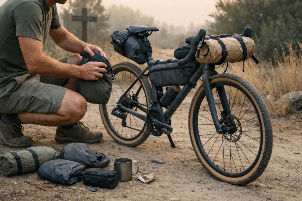
Trip Prep: Checklist + What to Do When Plans Break
What you do before you leave is what determines how you handle it when things go sideways. These two conversations are really one.
Before you leave: the non-negotiables
- Offline maps downloaded — Gaia GPS or RideWithGPS; cell signal drops on every route here
- Water plan mapped out — mark every confirmed source, note the longest gap, decide your carry capacity. The max water gap column in the comparison table above is your starting point; see how much water capacity you actually need. Finding reliable bikepacking routes with water is half the battle — plan around confirmed town stops, not wishful creek crossings.
- Build a rough bikepacking campsites map — confirmed dispersed sites, backup campgrounds, and water stops all downloaded offline before you leave
- Camping regs checked for each land management section — rules change at jurisdiction boundaries mid-route
- Route planned in full — build your GPX, mark water, and set realistic daily targets before you commit
- Itinerary shared with someone who will notice if you don't check in
- Weather checked for the whole route corridor, not just the trailhead
Gear that earns its weight on free routes
This page contains affiliate links and may include sponsored content. As an Amazon Associate, I earn from qualifying purchases at no extra cost to you. Amazon links are labeled #ad; other affiliate links may be marked as "affiliate link," "Sponsored," or "(paid link)." Learn more.
- Water filter + backup tablets — carry both; filters fail at the worst possible times
- Extra water capacity — 4+ liters for desert routes (#1, #2), 2–3 liters for the rest
- Emergency bivy or lightweight shelter — unexpected weather changes plans fast on remote routes
- Bike repair basics — tubes, patches, multi-tool, chain links, tire plugs
Water filter I trust on every route:
Sawyer Squeeze — Lightweight, reliable filter I've used on every route on this list. Works inline with a soft bottle. ~$37 with two pouches included.
When plans break mid-route
If a campsite becomes unavailable, the fallback is a nearby town — look up budget motels before you leave. Local bike shops often know dispersed spots that aren't on any map. If a trail closes mid-route, parallel forest roads exist for most of these routes — have the topo downloaded, not just the GPX.
Frequently Asked Questions
Conclusion
These free bikepacking routes USA picks — from Arizona's Sonoran Desert to Pennsylvania's rail-trail canyons — keep proving the same thing: the best rides don't come with a fee attached. Seven routes, seven completely different landscapes, and not a single required permit between them.
Pick the one that matches where you are right now — not the one that looks most impressive. The Olympic Discovery Trail and Pine Creek are genuinely great rides. You don't have to earn the right to do them by starting with something harder.
Verify conditions. Map your water. Tell someone where you're going. Then go.
Want more options? Browse the full bikepacking routes hub for more free and low-cost ride ideas across every terrain and skill level. New to touring entirely? The Beginner Bikepacking Guide covers everything — gear, prep, and what to expect on your first overnighter — before you commit to any of these.
For navigation, the Gaia GPS vs AllTrails guide breaks down which offline mapping app handles remote terrain best. Planning to sleep out? The solo wild camping safety tips section covers site selection, legality, and the basics that make dispersed camping actually comfortable.
Written from personal experience riding and scouting these routes over the last five years. Route conditions, water availability, camping regulations, and trail access change — always verify with the relevant land management agency before your trip. This post is for general information only, not a substitute for current official guidance. Results and conditions vary; plan accordingly.